


G.Re.T.A.
Permanent geoelectrical monitoring
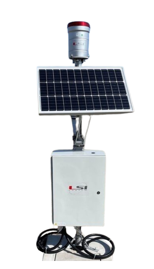
G.Re.T.A. (GeoRestivimeter for Time lapse Analysis) is the most effective and innovative solution for Permanent Geoelectrical Monitoring of the conditions of large sections of soil.
DATA SHEETS
Description
Description
Permanent geoelectrical monitoring
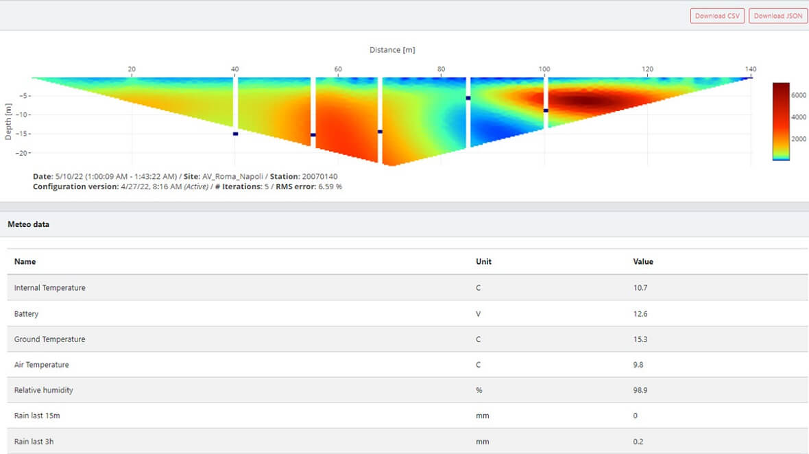
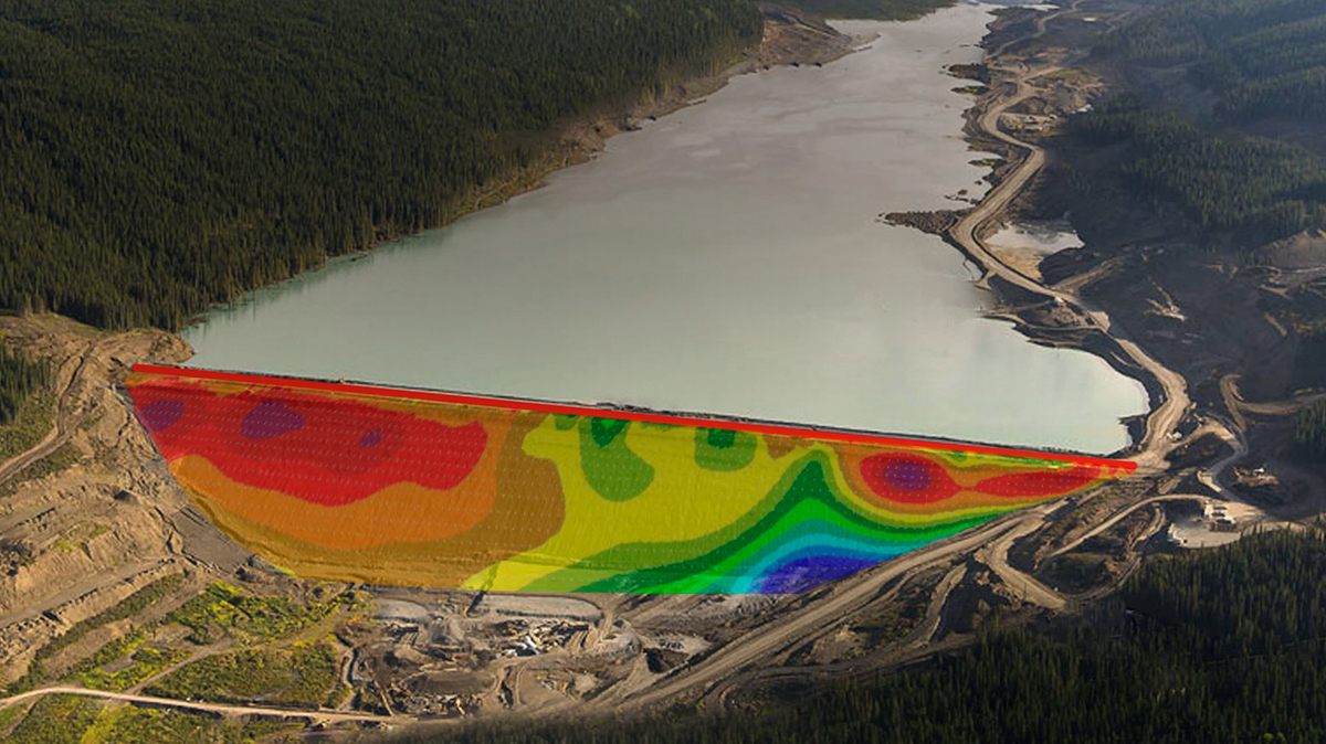
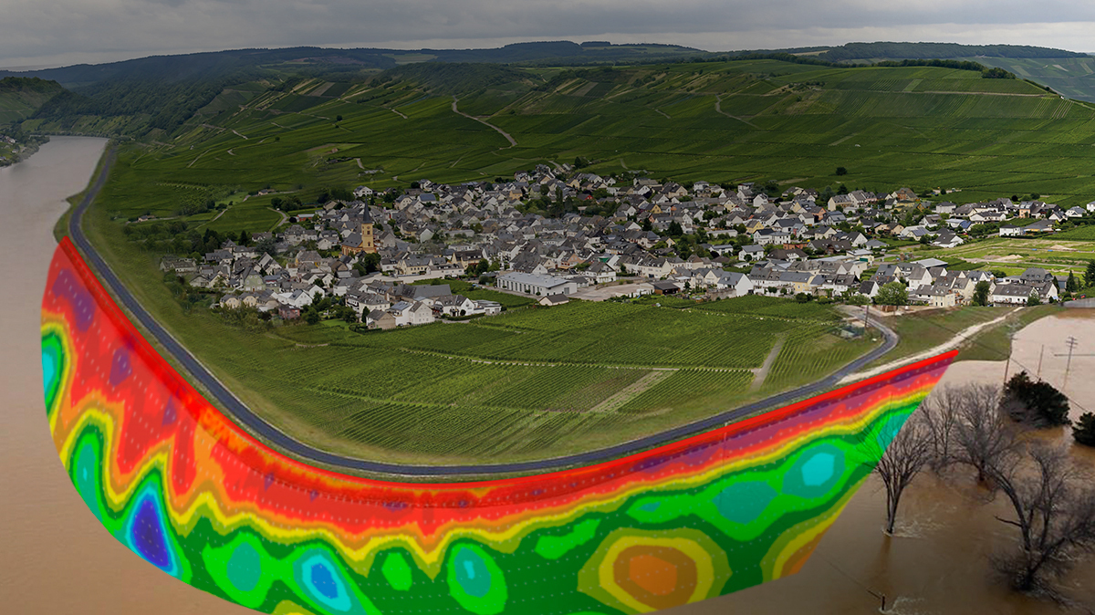
This instrument measures the alteration over time of the soil’s resistivity profile, functional to the characterization of the same in terms of water content, presence of cavities or other anomalies.
Electric Resistivity Tomography (ERT) is based on the insertion of an electric field in the ground through electrodes (input electrodes), and the measurement of the voltage through other electrodes (measurement electrodes).
From the measure of the voltage it is possible to obtain, through the second law of Ohm, the resistivity value, a peculiar characteristic of all materials.
G.Re.T.A.
Highlights
- Off-the-shelf, easy to install monitoring solution;
- Remote sensing, with data visualizations and configurations via Cloud software;
- Energy autonomous system;
- Soils’ % water content calculation along the entire monitored profile.
- Automatic Alarm messages when thresholds are reached;
- Model code: GRT2A0100.
FAQ: Frequently Asked Questions
What is G.Re.T.A. and when is it preferable to use it instead of traditional geotechnical measurements?
G.Re.T.A. is a permanent geoelectrical monitoring solution based on ERT (Electrical Resistivity Tomography), designed to track changes in soil resistivity over time. Compared with single ERT measurements, it is more suitable when the evolution of subsurface phenomena needs to be observed over time.
What are the main strengths of G.Re.T.A. in applications on earth dams, embankments, and tailings storage facilities?
Its main strengths are continuous monitoring, wide spatial coverage, the ability to highlight variations related to water content, seepage, cavities, and other anomalies, and cloud-based data availability. In situations where subsurface conditions change over time, the main advantage is the ability to see trends and evolutions, not just occasional measurements.
Why can continuous geoelectrical monitoring be more effective than periodic survey campaigns?
Periodic survey campaigns provide useful information, but only at specific moments in time. A continuous system such as G.Re.T.A., on the other hand, makes it possible to track the evolution of the geoelectrical profile over time, detect progressive changes, and trigger alarms when defined thresholds are exceeded. This approach is particularly useful when the goal is to identify phenomena before they become operational or structural criticalities.
Is G.Re.T.A. a complex solution to install and manage?
No, one of G.Re.T.A.’s strengths is precisely its off-the-shelf approach. The solution is designed for field installation with plate or stake electrodes depending on the application, it can be energy autonomous, and it allows cloud-based data visualization and remote configuration. This makes it easier to move from a survey-based approach to a permanent monitoring strategy.
Can G.Re.T.A. integrate other useful monitoring information in addition to geoelectrical data?
Yes. G.Re.T.A. can also integrate additional environmental and instrumental data, for example through a dedicated data logger, with cloud-based visualization. This is an important advantage when the customer wants to correlate geoelectrical data with rainfall, weather parameters, piezometers, or other site measurements, obtaining a more complete interpretation of the monitored phenomenon.
Additional information
Additional information
| Grandezze | |
|---|---|
| Applications |
Product
greta
Category G.Re.T.A.
Permanent geoelectrical monitoring
This instrument measures the alteration over time of the soil’s resistivity profile, functional to the characterization of the same in terms of water content, presence of cavities or other anomalies.
Electric Resistivity Tomography (ERT) is based on the insertion of an electric field in the ground through electrodes (input electrodes), and the measurement of the voltage through other electrodes (measurement electrodes).
From the measure of the voltage it is possible to obtain, through the second law of Ohm, the resistivity value, a peculiar characteristic of all materials.
G.Re.T.A.
Highlights
- Off-the-shelf, easy to install monitoring solution;
- Remote sensing, with data visualizations and configurations via Cloud software;
- Energy autonomous system;
- Soils’ % water content calculation along the entire monitored profile.
- Automatic Alarm messages when thresholds are reached;
- Model code: GRT2A0100.
FAQ: Frequently Asked Questions
What is G.Re.T.A. and when is it preferable to use it instead of traditional geotechnical measurements?
G.Re.T.A. is a permanent geoelectrical monitoring solution based on ERT (Electrical Resistivity Tomography), designed to track changes in soil resistivity over time. Compared with single ERT measurements, it is more suitable when the evolution of subsurface phenomena needs to be observed over time.
What are the main strengths of G.Re.T.A. in applications on earth dams, embankments, and tailings storage facilities?
Its main strengths are continuous monitoring, wide spatial coverage, the ability to highlight variations related to water content, seepage, cavities, and other anomalies, and cloud-based data availability. In situations where subsurface conditions change over time, the main advantage is the ability to see trends and evolutions, not just occasional measurements.
Why can continuous geoelectrical monitoring be more effective than periodic survey campaigns?
Periodic survey campaigns provide useful information, but only at specific moments in time. A continuous system such as G.Re.T.A., on the other hand, makes it possible to track the evolution of the geoelectrical profile over time, detect progressive changes, and trigger alarms when defined thresholds are exceeded. This approach is particularly useful when the goal is to identify phenomena before they become operational or structural criticalities.
Is G.Re.T.A. a complex solution to install and manage?
No, one of G.Re.T.A.’s strengths is precisely its off-the-shelf approach. The solution is designed for field installation with plate or stake electrodes depending on the application, it can be energy autonomous, and it allows cloud-based data visualization and remote configuration. This makes it easier to move from a survey-based approach to a permanent monitoring strategy.
Can G.Re.T.A. integrate other useful monitoring information in addition to geoelectrical data?
Yes. G.Re.T.A. can also integrate additional environmental and instrumental data, for example through a dedicated data logger, with cloud-based visualization. This is an important advantage when the customer wants to correlate geoelectrical data with rainfall, weather parameters, piezometers, or other site measurements, obtaining a more complete interpretation of the monitored phenomenon.